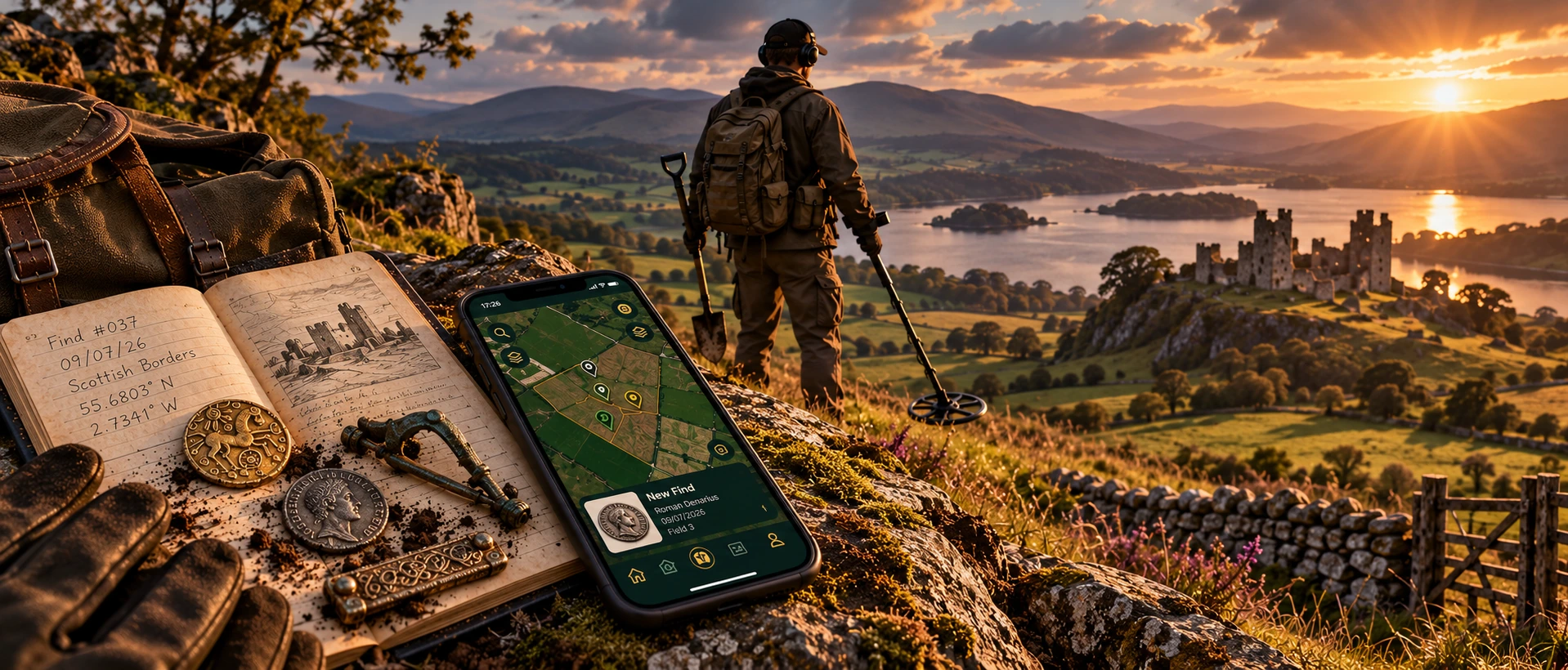
Log Your Finds
Multiple photos, GPS, provenance, notes and the field, session or event behind the find.
COMING SOON TO iOS & ANDROID
One app for the whole detecting journey. Map your finds, explore trusted historical layers, view LiDAR, manage permissions and record every session.
Research → Plan → Detect → Record → Manage → Preserve
Multiple photos, GPS, provenance, notes and the field, session or event behind the find.
Trusted heritage context, monuments, Roman roads, medieval research and source-aware layers.
Read the landscape, contours and field detail in a new way.
Farms, fields, landowner access, navigation points and detecting sessions.
ONE SYSTEM • THE COMPLETE DETECTING JOURNEY
From the first look at the landscape to the record you keep afterwards, MDL keeps the important context connected without turning fieldwork into admin.
APP PREVIEW • ONE WORKFLOW. FROM RESEARCH TO RECORD.
Plan with historical context, work the field with live mapping, then preserve every find with its place, session and permission attached.
Scheduled Monuments ON
Medieval ON
Roman Roads ON
Medieval • Silver
COMING TO iOS & ANDROID
EXPLORE THE LANDSCAPE BEFORE YOU DIG
From prehistoric landscapes and Iron Age earthworks through Roman Britain, the Early Medieval world, Medieval Britain and later historic landscapes, Metal Detecting Log brings trusted heritage context and field research together in one place.
Scheduled Monuments ON
Medieval ON
Roman Roads ON
Canmore ON
Explore earlier landscape context, earthworks and field systems alongside the records and layers available in MDL.
TERRAIN • CONTOURS • FIELD CONTEXT
LiDAR adds another way to read the ground — helping subtle earthworks, contours and landscape features stand out while your finds and permissions remain part of the same MDL workflow.
MORE THAN A FIND LOG
Permissions are part of the product, not an afterthought. Farms and fields stay organised, active permissions can be shown on the main map, and session history gives both detectorists and landowners a clearer record of activity.
✓Field-by-field control for availability and status.
✓Session START / END records with time and location.
✓Event permissions with organiser and participant roles.
✓Privacy-aware profiles so landowners only see what is appropriate.
MDL adds an extra safety check around protected heritage context, helping you spot sensitive areas while planning and working with permissions. It supports responsible decision-making — it does not replace landowner permission, official designation records or legal guidance.
FROM ACCESS TO ACTIVITY
Once you are on the land, MDL keeps the outing tied to the place, permission and time it belongs to — then carries that context into the finds you record.
Start and end a timed session with location and permission context attached. Finds made during the outing can stay connected to the session they came from.
Keep photos, GPS, notes and provenance together. Gallery imports can retain original EXIF location, while farm, field, session and event context can remain attached to the discovery.
MOBILE IN THE FIELD • PORTAL FOR MANAGEMENT
Metal Detecting Log follows the job instead of forcing every task onto one screen. Use the mobile app while researching and detecting, then move to the Portal when farms, fields, people and events need more space.
Research historical context, view LiDAR, navigate to the farm or parking point, start a session and capture the find while its context is still fresh.
A larger workspace for detectorists, landowners, estate teams and event organisers — with role-aware access to the information each person actually needs.
LAND • ACCESS • ARRIVAL
Permissions go beyond a saved farm name. Keep field polygons and availability organised, preserve activity history and save the practical arrival points detectorists need on the day.
✓Farm Location can guide you directly to the farm.
✓Parking stays separate so arrival instructions remain clear.
✓Meeting Points can support organised events and rallies.
✓Finds and sessions retain their land and field context.
FROM A SMALL EVENT TO A MULTI-DAY RALLY
Hosted Events has grown into a complete organiser workflow: build the event, reuse farm fields, assign detecting days and infrastructure, guide participants, track sessions and review what happened afterwards.
Reuse existing farm polygons inside an event instead of drawing the same land again.
Overview plus day views, with detecting availability assigned by day across multi-day rallies.
Detecting, Camping, Parking, Camp & Park, Entertainment and Restricted areas, plus Meeting Point and key contacts.
Participants get the event information they need without gaining organiser controls.
Event sessions, finds and organiser reporting keep the story of the rally together after the fields close.
ONE SYSTEM • DIFFERENT ROLES
MDL adapts the working view to the job — without treating every account as if it needs access to everything.
Historical research, permissions, sessions, finds and your own detecting record.
Relevant farm, field, session and find information without exposing unnecessary private profile data.
Plan rallies, manage participants and infrastructure, then review event activity afterwards.
MDL REPORTS
Turn the information already held in MDL into clear reports — matched to the account and records you have access to.
OFFICIAL FIND REPORTING • A SEPARATE WORKFLOW
Generating an MDL activity report is not the same as officially reporting an archaeological find. MDL keeps these workflows clearly separate.
Prepare the relevant find information for the appropriate Scottish reporting route.
Keep the find record and provenance ready for the appropriate Finds Liaison Officer / PAS workflow.
WHY METAL DETECTING LOG
01Maps in one place.
02Permissions somewhere else.
03Photos buried in the gallery.
04GPS, notes and event details split across apps and messages.
MDL brings the detecting record together.BEFORE THE FIRST SIGNAL
Straight answers on coverage, privacy, historical data, LiDAR, land management and hosted events before launch.
More launch & support information →MDL is being built around UK detecting workflows. Dataset availability and reporting routes differ by nation, so the product presents relevant tools in context rather than pretending every jurisdiction works identically.
Find records can keep multiple photos, GPS, title, notes and provenance together, with links to the relevant farm, field, permission, session or event. Gallery imports can use the photo’s original EXIF GPS where available.
No public-sharing model is assumed by default. Precise locations and permission information are sensitive data and the product is being designed around controlled access and privacy-aware roles.
The Historical Maps area is designed for heritage context including scheduled monuments, listed buildings, Canmore, battlefields, medieval data, Roman roads and other relevant layers, with sources and layer controls kept visible.
Yes. LiDAR is planned as a dedicated map experience for reading terrain, earthworks and field contours while keeping your own finds and permission boundaries in context.
Yes. Permissions, farms, fields and hosted events are core parts of the system. Roles are separated so organisers and landowners can manage relevant access without automatically exposing unnecessary personal information.
The Portal is the larger-screen management side of MDL for workflows such as farms, fields, finds, sessions and hosted events. Access is role-aware so detectorists, landowners, estate teams and organisers see the tools relevant to them.
Yes. The event workflow supports multi-day field planning, day-specific detecting access, infrastructure areas, meeting points, organiser and participant views, event sessions and post-event records.
THE NEXT CHAPTER IS COMING
Join the launch list for release news, early previews and availability on iOS and Android.
Metal Detecting Log is being built around real detecting workflows in the UK — connecting historical research, live fieldwork, find provenance, land permissions, sessions, rallies and role-aware management across the mobile app and MDL Portal.